Welcome to the Explore! New Mexico blog

Explore! New Mexico searches the state for interesting stories to tell our listeners and readers - and now our blog followers! We are currently producing a series of multi-media podcasts for the Las Cruces Convention and Visitors Bureau about interesting events and places to visit. You can view them at our YouTube channel. Be sure to visit our website where you can get even more ideas about where to travel in the Land of Enchantment.
Showing posts with label travel. Show all posts

Friday, April 29, 2011

Lake Valley Clings To Its Colorful Past


If you’d visited Lake Valley in the 1850s, you would have seen mostly flat, grassy plains, low rounded hills, and the majestic Black Range ensconced on the horizon. You might have thought the valley serene, even idyllic.

Then in 1878, a rancher named McEvers or perhaps a prospector named Lufkin found silver ore. It was however low-grade, not much more than 40 ounces or 2-1/2 pounds of silver for every ton of rock dug. Remember, in those days, there were no electric or steam-driven mining machines. Dug meant pick and shovel, a hand-hammered drill, and maybe some dynamite, which had been invented in 1867.

In 1881, J. Whitaker Wright arrive in Lake Valley with George Daly, an Australian immigrant. The two men, along with George Roberts, formed the Sierra Grande Silver Mining Company. Their efforts to exploit the silver was frustrated because there appeared to be none but the low-grade ore.

Meanwhile, Apaches, led by Nana, decided the ranchers and miners had been in their homeland long enough and began raiding. They burned a rancher’s home and kidnapped his wife and children. George Daly led a group of miners in retaliation. His efforts cost him his life.

It was when they brought Daly’s body back to Lake Valley, the miners found the motherlode at a depth of 40 feet. I am reminded of a scene in Paint Your Wagon, where the vagabond miners are digging a grave for a compadre killed in a wagon accident, only to see gold glittering in the dirt. The response is hilarious if crude. And I wondered if Lake Valley silver was found that way when Daly’s grave was dug.

However, it worked out, miners excavated what became known as the Bridal Chamber and found a vein of silver so pure it was assayed at thousands of ounces per ton. One writer referred to the mine as having walls of pure silver. The Bridal Chamber gave up $2,775,000 in silver, becoming known as the richest silver mine ever found.

Of course, that’s when the trouble began. A rich strike brings more miners to town, sort of like vultures drawn to a corrupting carcass. The quiet town grew to have upwards of 4,000 residents, mostly men. So there were nearly two dozen saloons and a few bordellos. There were also “legitimate” businesses – general stores, hotels, drug store, barber shop, post office, livery, stage line, and assay office. There were also a church, school, and doctor in residence.

In a short time, miners had dug hundreds of shafts looking for more of the elusive silver. To keep cash flowing for mining operations, Wright and Roberts apparently salted areas or convinced naive investors the ore was richer than it was. These promotions made Wright a multimillionaire, while it made paupers out of many investors. By 1882, Robert’s fraudulent promotions threatened the company, and he sold out to Wright. Meanwhile, Wright’s questionable promotions led to a conviction of stock fraud in London in 1902, and he swallowed cyanide, committing suicide in the courtroom.

But I’m ahead of my story. In 1893, President Grover Cleveland changed the standard upon which paper money was based from silver to gold. Not only did silver prices plummet, the change also contributed to the Panic of 1893, a major economic depression that tipped the scales on many Lake Valley businesses. Silver mining was pretty much done by then.

Besides all the mining activities, ranching had remained a major industry in Lake Valley. Cattle in large numbers bring in rustlers in large numbers. Bob Alexander, in his book, Desert Desperadoes, recounts an episode of “door-bustin’ roundups at Lake Valley, Hillsboro, and Kingston.” The roundup was led by Major Albert Fountain and was intent on rooting out and destroying rustlers, led by John Kinney, whose Lake Valley ranch served as headquarters for the outlaws. The gunfights that followed were brutal. One newspaper reported alleged escaped prisoners were shot to pieces.

So went life in Lake Valley, a town in decline. One night in 1895, a man named Abernathy, a disgruntled and perhaps drunk customer of William Cotton’s saloon, set the bar on fire. Tinder dry wood and high winds fanned the flames, which consumed nearly all of Main Street, including the Keller, Miller & Company mercantile. Today, you know exactly where that store stood. Its safe sits in the dirt right where it was after the fire burned itself out.

Like all ghost towns, Lake Valley was never totally abandoned. Its life simply ebbed away every so slowly. Mrs. Blanch Nowlin, who became the local dealer for Conoco, lived in her house on Railroad Avenue until 1982. Pedro and Savina Martinez bought the Belle Hotel next door. He lived there until his death in 1994, having been a Lake Valley resident for 90 years.

During World War II, manganese was mined in the town, but that too was mined out and abandoned in the early 1950s.

I thought about this history as I walked the remains of the town. The Bureau of Land Management is responsible for Lake Valley [along with the still remaining Sierra Grande Mining Company]. The BLM restored the 1907 schoolhouse and turned it into a museum. Mrs. Nowlin’s Conoco store was the original school built in 1880. It’s awaiting a new roof and other restoration. I looked in at the chapel, where Episcopal services were held until the 1970s, and examined the remains of the Keil House and Dr. Beal’s House. The Nowlin and Martinez houses are privately owned and undergoing stabilization, efforts to prevent them from collapsing, so they might be opened to visitors.

Bob Denison, resident BLM manager, took me in his ATV to see the Bridal Chamber and other mines still on private property. I saw what’s left of the manganese ore processor. I saw head frames standing above a few of the 430 mine shafts dug throughout the area. One mine, the Last Chance, is home to bats and monitored by the state, watching for white-nose syndrome. Another, Denison told me, is the den of a mountain lion. None of them ever produced silver as rich as the Bridal Chamber, which has mostly collapsed as its timbers have aged.

Time is not kind to the remnants of our history and, unless someone values Lake Valley at lot more than it is now, it too will fade away, leaving behind decaying piles of lumber and melting mounds of ancient adobe. And that will be too bad because at Lake Valley, we can examine our colorful past and know better the roots from which we have grown.


Posted by Bud Russo


Monday, January 31, 2011

Mile Markers Are Giving Me a Great Education!

Can't tell you how much I'm learning! Having to research and write 260 Mile Marker radio features this year is quite a challenge, but it's turning into a fascinating education. There are so many interesting people who live ... and have lived ... in New Mexico ... so many stories, some funny, some tragic, some dramatically violent. I'm working on a story about a sheriff who got into a gunfight with drunk cowboys who would not relinquish their guns. The sheriff was killed. One cowboy was killed, two were wounded, the fourth escaped unharmed. One cowboy was gut shot so he couldn't run. The other two got away, but later were captured. All three were executed. The sheriff's deputy became sheriff. Now that was pretty normal for New Mexico in the 1800s. What sets this story apart is ... oops. If I tell you now, will I have to shoot you? Listen to our Mile Markers on KRWG in Las Cruces, KENW in Portales, or KSJE in Farmington ... or catch up on our New Mexico tales at our web site ... explorenewmexico.biz. We post all the Mile Marker stories the week after they've been broadcast. Have fun. I certainly am.

Bud Russo

Doña Ana Poised For Future as Tourist Destination


The wagons churned along the Rio Grande over El Camino Real, advancing only a dozen miles or so each day. Travelers stopped at camps or parajes between Mexico City and Santa Fe. Most of those camps are distant memories, lost in the shifting sands of the desert and the changing course of the river. One of the camps has persisted into the 21st century. We know it as the village of Doña Ana.


On January 15, State Senator Mary Jane Garcia hosted the grand opening of the De La O Visitors Center in Doña Ana, culminating many years’ work of the many descendants who claim the name De La O and creating a focal point for community activities and tourists.


During the festivities, Sen. Garcia asked a show of hands of those who have come from the original De La O family. The senator is cousin to many of the village’s residents. She pointed to one man and asked if he was De La O, to which he concurred. Said the senator, “I’ve known you 20 years and didn’t know you were De La O. Hello, cousin!”


Those attending the grand opening included Las Cruces Mayor Ken Miyagishima, several Las Cruces City Councillors,

representatives of Doña Ana County government, and other dignitaries. Unlike most other similar events, this one had the festive appeal of a family reunion.


Doña Ana dates to the late 17th century. The village, if if could have been called that at the time, was abandoned throughout most of the 18th century. According to Robert Julyan in his book, “The Place Names of New Mexico,” the governor of Chihuahua created the Doña Ana Bend Colony Grant to alleviate crowding in El Paso. But it was not settled until 1843 when Bernabé Montoya led thirty-three settlers to the site. They named their settlement after the semi-legendary Doña Ana, who may have been Ana Robledo who had fled south during the Pueblo Revolt, or Doña Ana María de Córdoba, whose ranch was nearby.


Whoever the name honored, settlers were determined to remain in their village, to farm and to thrive. El Camino Real ran through the heart of the village. It brought not only travelers and trade but also bandidos. It was also prey to

marauding bands of Apache. But it persisted.


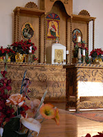
Between 1845 and 1850, a decade before the village of Las Cruces was laid out, villagers built a church. It was about a hundred feet long and twenty feet wide. Its adobe walls were three feet thick and its windows high to prevent Indians and bandits from shooting at people sequestered there. Candles in chandeliers and sconces between the Stations of the Cross dimly lit the church. A single clerestory window above the nave close to the apse let in the early morning light to illuminate the altar during Mass.


During the Civil War, De La O opened a saloon about a hundred yards south of the church. Just north of the saloon, Werthheim opened a general store, and north of that was the residence of the Cavello family.


Those buildings have persisted into the present time, but barely. In the late 1970s, the church was about to be condemned and demolished. The adobe buildings down the street had faired better, perhaps because of their boxy single-story construction. The structures seemed destined to melt into history just as old adobe returns to the earth.


But the community, led by Sen. Garcia, had other plans. Over a decade, Doña Anans, including some at-risk youth, rebuilt the church. They made more than 17,000 adobe bricks to reconstruct one wall which had collapsed and to shore up other parts of the building. Using a design of local artist Jeannie De Lo O Carbajal, who designed the art adorning the I-25 underpass at Highway 320, artisans in Mexico built a new altar patterned on the original which had deteriorated too far to reclaim. They retained the church’s original vigas and corbels and conserved the original French paintings of the fourteen Stations of the Cross. The church today is used for special occasions, including baptisms and marriages.


Then restoration work shifted down Camino Real, which for nearly two decades has been called Cristo Rey, to the old saloon and adjacent buildings.


The L-shaped De La O saloon has been restored with two meeting rooms and the mirror-backed bar, just as it might have looked 150 years ago. Its adobe has been painted white and its walls hung with historical scenes of the village of two centuries ago. Behind the building is a brick placita with fountain, stone planters, and shade trees. The community now has a facility for activities, celebrations, and fiestas.


As funds permit, the Werthheim building will be restored as a mercantile museum and the Cavello house will become the site of a farmers’ market.


For those who think Camino Real is nothing more than two ruts in the desert, come to the village of Doña Ana and see what family can do.


If you’d like to see the restored historic buildings and walk along part of the original royal highway, take Exit 9 off I-25 and turn south on Thorpe Road (NM-320). At the modern Catholic church, Our Lady of Purification, turn left onto Dusty Lane, which bends around the church and becomes Cristo Ray Street.


Monday, January 24, 2011

Want to be on TV? Go to Sparky's!

Perhaps the phrase “If you build it, they will come” applies to restaurants as well as baseball fields. Josie and Teako Nunn have spent the last three years building their business, Sparky’s Burgers, Barbecue, and Espresso, in Hatch, New Mexico. The delicious food and fun atmosphere have brought it to the attention of a number of media outlets. It was recently mentioned in Sunset magazine with a larger article coming this fall, and featured in segments on KRWG-TV Newsmakers, Explore! New Mexico’s radio show, and Spicy RV, along with rave reviews in newspapers and on lots of travel and food websites.


Recently, they were contacted by the producers of an upcoming Discovery Channel show, “Road Eats.” A film crew will descend upon the funky eatery on Wednesday, February 2, from 9 a.m. until 4 p.m. to film the staff and diners. This is a day the restaurant is usually closed, so Sparky’s fans are encouraged to take time to come enjoy a meal that day and perhaps be able to see themselves on the Discovery Channel show when it is aired.


Sparky’s has received attention lately not only for its delicious smoked barbecue ribs, pulled pork, brisket, and green chile cheeseburgers (a must in the chile capital of the world!), but even international news coverage for the oversized statues that grace the building’s grounds - and the roof. Visitors pose with Colonel Sanders, who sits on a bench, or Ronald McDonald, and snap photos of the A & W Root Beer family that is perched on the roof. A giant rooster sits across the street pointing the way to the barbecue joint, which also features a wide variety of coffee drinks and shakes, with fun names like “Stellar Madness” and “Hot Chocolate Rocket.”


Sparky’s was recently expanded to allow room for more patrons to dine and to add a stage. The Nunns wanted to offer live music to make the atmosphere even more festive and engaging, so now on Sundays they have bands playing while folks enjoy their barbecue and coffee. Music is performed Sundays from 12:30 to 3:30 p.m. in the Sparky’s Green Chile Room.


“It’s been fun doing this. Sparky’s started as a hobby and we even thought we could run the restaurant part-time, but it has turned into a full-time adventure,” says Josie Nunn.


Regular restaurant hours are Monday, Thursday, and Sunday from 10:30 a.m. until 7 p.m. On Friday and Saturday, they stay open until 7:30 p.m. They are closed Tuesday and Wednesday, except when Discovery Channel comes calling. The restaurant is located at 115 Franklin Street in Hatch. For more information on Sparky’s Burgers, Barbecue and Espresso, check their website at www.sparkysburgers.com.


- Posted by Cheryl Fallstead

Tuesday, September 28, 2010

An Encounter With Otero Mesa: Learning What Makes It Unique


I’m standing on a hillock in the middle of Otero Mesa, the last remaining Chihuahuan Desert short-grass prairie left on public lands in the U.S. I find it hard to comprehend how vast this grassland is. Knowing it’s 1.2 million acres just doesn’t do it. I turn in a slow circle and look out over the plateau. From where I am to the horizon in every direction there is the undulating grassland. Sixty-some miles to the north are the Sacramento Mountains. To the west are the Hueco Mountains and to the east are the Cornudas Mountains, which block my view of the Guadalupe Mountains farther east. The plateau within this triangle of mountains constitutes Otero Mesa.


The human footprint here is still relatively light. Ranchers lease much of the BLM-managed lands for cattle. Other than that, the land seems empty. It is anything but. Life, comprised of more than 1,000 plant and animal species, abounds everywhere I look.


Ever since joining the New Mexico Wilderness Alliance (NMWA) I had heard about Otero Mesa and I had wanted to experience it. On a weekend in late September, Cheryl Fallstead and I joined Nathan Newcomer, NMWA associate director, and about a dozen people at a campsite in the shadow of Alamo Mountain, the highest peak in the Cornudas.


Saturday most of the campers elected to hike the a steep trail to the summit of Alamo Mountain, some 1400 feet above the plain. They were promised a grand view of the entire mesa and were not disappointed.


Cheryl and I joined Steve West, NMWA staff scientist, to conduct wildlife surveys at several stock ponds out on the plateau. Otero Mesa is high on the Department of the Interior’s list of possible new national monuments and knowing the variety and extent of plant and animal life contributes to our understanding of the land and why it should be protected.


Instead of the grand view, we got up close and personal. We sited and identified more than forty of the 250 species of birds that call Otero Mesa home or which migrate through the area. I’m not a birder so this was an education, learning to tell the difference between a bunting and a warbler; a Vesper’s sparrow from a Brewer’s sparrow. I was more impressed with the raptors we sighted: the osprey, northern harrier, red-tailed, Swainson’s, and Cooper’s hawks. We saw waterfowl – red and green-winged teal, an American coot, and American avocet – and one magnificent hummingbird. That’s not an exaggeration. That’s its name: Magnificent.


We listed plants not yet identified in other areas on the mesa. I learned how to tell the difference between a croton and a winter fat plant and about the all-thorn or crucifixion-thorn tree. The trees we were looking at grow exceedingly slow and may have been more than a century old.


What was most obvious was the change in plant assemblages. In some areas there was an abundance of gramma grasses studded with yucca, indicative of healthy grassland. Other areas were carpeted with yellow snakeweed, mesquite, and prickly pear – signs of poor range management over the century or more cattle have been grazed here. How to give the land respite and let it recover are issues now being debated.


As evening arrived, we helped set up mist nets to trap birds, which West was banding. Each one he caught, he measured and weighed. He was excited to find and band an orange-crowned warbler and a cordilleran flycatcher.


There were other exciting moments during the day. We spotted several pronghorn, some single males and others with their harems. Pronghorns we were told are not antelopes but last surviving species of nine Pleistocene animals, which thrived as long as two million years ago. That may account for their strangely shaped horns and head that’s out of proportion to their bodies.


As the sun settled over the Hueco Mountains, we were treated to a delightful coyote howl. I expect the coyotes were simply letting each other know they were in close proximity, maybe on the edge of each other’s territory but, to me, they sounded more like an a cappella choir in four-part harmony.


Sunday was a day of exploring human history rather than natural history. Newcomer led our group up to the first bench on Alamo Mountain to see some of the hundreds of petroglyphs. Many of the rock-art creations are thought to have been made by the Mescalero Apache whose territory was near the area in the mid-1800s. Designs of horned characters and zigzagging lines may represent Apache deities of wind, rain, thunder, and lightning. Drawings of horses suggest many of the petroglyphs date from the 1600s, although other artifacts and potsherds indicate native people have inhabited the area for thousands of years.


As you might expect, there was a wide range of artistry. Some rock artists could do no more than make stick figures; others had the competence to do remarkable images of fish, owls, bear paws, and what looked like a rainbow. He also pointed out a broad bowl in which archeologists have found pit houses and other evidence of human occupation. Newcomer said he expects scientists will find pottery, tools, charcoal from old campfires, and perhaps even human remains. We looked into the bowl from its edge and turned away. No one wanted to disturb an area that could enlighten us about those occupying the land long before us.


Our last stop was the remaining stone walls of the Butterfield Stage station, one of 140 stations along the trail from St. Louis to San Francisco. Perhaps impressed by the Native American rock art, a number of Anglos – maybe travelers, maybe cowboys – etched there names and the dates of their passing.


If our ride onto Otero Mesa was like venturing into a brave new world, our ride home was like leaving an old friend, one we’re sure to revisit time and again, certain each visit will reveal new wonders.


Posted by Bud Russo

Tuesday, July 13, 2010

Taos Daytrip: Kit Carson, Blumenschein & Bent

On our last day of travel, we headed along the High Road to Taos. Once there, we visited the Kit Carson Home and Museum as well as Carson's grave, stopped by the Gov. Bent house and gift shop, and toured the Blumenschein house and museum. In between we popped into any number of interesting galleries -- for which Taos is known.

Highway 68 runs from Espanola to Taos. That's how we came home. On our way there, we took thefamous High Road through Nambe, Truchas, and Penasco. The road wound and turned, often taking us back the way we came before heading northeast again. We rambled through juniper/pinon dotted hills with pine forest climbing higher up the mountains. Mt. Wheeler, the highest peak in NM, towered over us. It's a strikingly beautiful drive and, as we climbed higher into the pine forests, enjoyed grassy meadows dotted with wildflowers. At one point we hit the shoulder. We had just stopped to photograph a lovely church that two artists were painting and had barely started driving again when there to our right was a log flume. That's right! Two 20-foot-long logs had been hollowed out to move water to where we had no idea, but the technology was straight out of the 18th Century.

Cheryl had a particular interest in the Kit Carson house. Her great-grandmother lived across the street from the Carsons in Taosand the two families were friendly. Kit Carson's home eventually included 12 rooms in a few separate buildings. We toured four rooms of his home, which comprise the museum. Some rooms in another building are unstable and unsafe, soare not included in the museum. Another set of rooms across a courtyard are part of a gallery and gift shop. The museum is owned and operated by the Masons, as Carson was a member and they wanted to preserve his legacy. It was an interesting look into the character and life of the American hero. We went next to see the graves of Carson and his third wife, Josefa Jamarillo.


I had an interest the the Gov. Charles Bent house. In 1847, after Gen. Kearny left Santa Fe for California, many of the Indians and Mexicans in Taos -- those who resented the American take-over -- rose in revolt. They stormed the Bent house and murdered the governor. While he held them off, his wife and daughter, and Mrs. Carson pushed a hole in a back wall and escaped. Mrs. Bent is buried in the same cemetery as the Carsons. Charles Bent's grave is not there.

Ernest Blumenschein, an artist from back East, was enroute from Denver to Mexico
when his wagon broke. He rode on horseback into Taos to get repairs and fell in love with the town. He is one of the founders of the Taos Society of Artists, the foundation of today's art
s community. His house consists of nine rooms. They
were built at various times from 1797 to 1924. He and his wife purchased three rooms in 1919 and as other buildings came on the market, they acquired them and expanded their residence between 1924 and 1931. Blumenschein, his wife, Mary, and daughter, Helen, all were artists and much of their art is on display, along with some of their furnishings. The house is interesting to explore and the art compelling. However,
we felt the $8 entrance fee was a bit steep.

Tired from walking and the heat, we headed south, stopping at the St. Francis of Asis church in Rancho de Taos -- a popular subject of painters and photographers -- and then dropped from the high plateau into the Rio Grande gorge.

I had read about an adobe home in Rinconada having two Mississippi riverboat capstans decorating it and wondered if the house is still there. The story dated to 1928. While we didn't find the house, we did meet Mark Saxe, who runs a stone carving school and gallery. He said perhaps the 90-year-old man across the highway might know, but advised not visiting his property unannounced. We decided to wait and see if Mark could contact his neighbor and inform us of the whereabouts of the capstans.

We returned to Santa Fe exhausted from our week of travel. We've had an exciting journey, and will have many more stories to tell -- after we've had a few days rest. And of course, we can't wait to return to do more exploring!

Posted by Bud Russo

Wednesday, July 7, 2010

Beautiful, Stormy New Mexico Skies

On our way north today, the sky treated us to one of New Mexico's finest attributes. We watched the clouds form tall columns and spread into whispy anvils at altitude. We first noticed them over the San Mateo Mountains near Socorro and then east over the Manzano Mountains. Cloud formations were quite beautiful all the way to Santa Fe. Best of all was the light. Dark clouds formed backdrops to mountains bathed in soft light. The juniper dotted hills seemed to glow with a life of their own. There were showers all around us but far enough away that we didn't get to drive through one. I've traveled across this country, across Europe, and Oceania. I have marveled at the natural beauty everywhere I've been, but I can truthfully say I have never seen skies like I see here in my adopted home.

So much for the poetry. Weather forcast tomorrow, heavy rain and flooding.

Posted by Bud Russo
Explore! New Mexico

We've arrived in Santa Fe!

We've arrived in Santa Fe and are settled into our condo. Tomorrow we'll begin exploring in earnest, by heading out to see several pueblos near Espanola, the chapel at Chimayo, and Abiquiu. Bud wants to go to Rinconada because he read that an adobe house there - 80 years ago - was adorned with two capstans from Mississippi river boats. If we find them, we'll take a picture and then tell you how Mississippi river boats ended up in northern New Mexico!

At Nambe Pueblo, we hope to see a cascading waterfall. At San Ildefonso, the home of famed potter Maria Martinez, we'll tour the pueblo and see the museum that displays the pottery of Martinez and others. Ohkay Owingeh was the home of Popay, who led the 1680 Pueblo Revolt, and today they have a herd of buffalo at the bison park. But truly, what we want to get a feel for is the uniqueness of each pueblo, the people and the artisans who call them home. We'll be able to tell you more after we've spent time at each tomorrow.

Abiquiu promises a museum of anthropology as well as a museum of paleontology and the Ghost Ranch Piedra Lumbre Education and Visitor Center. South of Abiquiu is the Pashouinge Ruins with vistas of the Chama River Valley.

So, a full day is planned for tomorrow! We'll keep you posted each day on our travels, so keep checking back.

Posted by Cheryl Fallstead
Explore! New Mexico

Monday, June 21, 2010

Explore! New Mexico website is available to view!

Visit our new website, www.explorenewmexico.biz for lots more information on exploring the Land of Enchantment. You can view some of our podcasts and listen to sample Mile Markers. We have calendar listings of upcoming events around the state, lists of travel ideas by type of tourism (agritourism, cultural tourism, science tourism and more), plus history of the state and much more. Check it out and let us know what you think!

Monday, April 26, 2010

Must see places and events in Las Cruces, New Mexico

Explore! New Mexico is producing multi-media podcasts for the Las Cruces Convention and Visitors Bureau. So far, we've produced one on wine tasting along Highway 28 and another on the connection between the Bataan Death March and our area. Almost complete is a podcast on hiking in the Organ Mountains and in progress is one on local museums. We are beginning research on an overview of Las Cruces - history, people, places, things to do.

We want our series of podcasts to tell visitors about the best we have to offer. So, when you visit Las Cruces - or if you live here, when your friends and family visit - what are don't-miss activities? Is it all about the Whole Enchilada Festival? Wine festivals? Heading to the Fountain Theatre for films in an adobe theater? Or is Cruces your jumping-off place to go to White Sands Nat'l Monument? Let us know so that our podcasts can help visitors make the most of their trips!

Tuesday, May 12, 2009

We're exploring New Mexico - for you!

New Mexico is the fifth largest state in the U.S. with a rich history and culture. That means that there are many stories to discover! Bud Russo and Cheryl Fallstead travel the state to find those stories and share them with you. We want to hear from you about where you've traveled in the Land of Enchantment - or where you'd love to go.